Dawn at The Serenghetto Waterhole

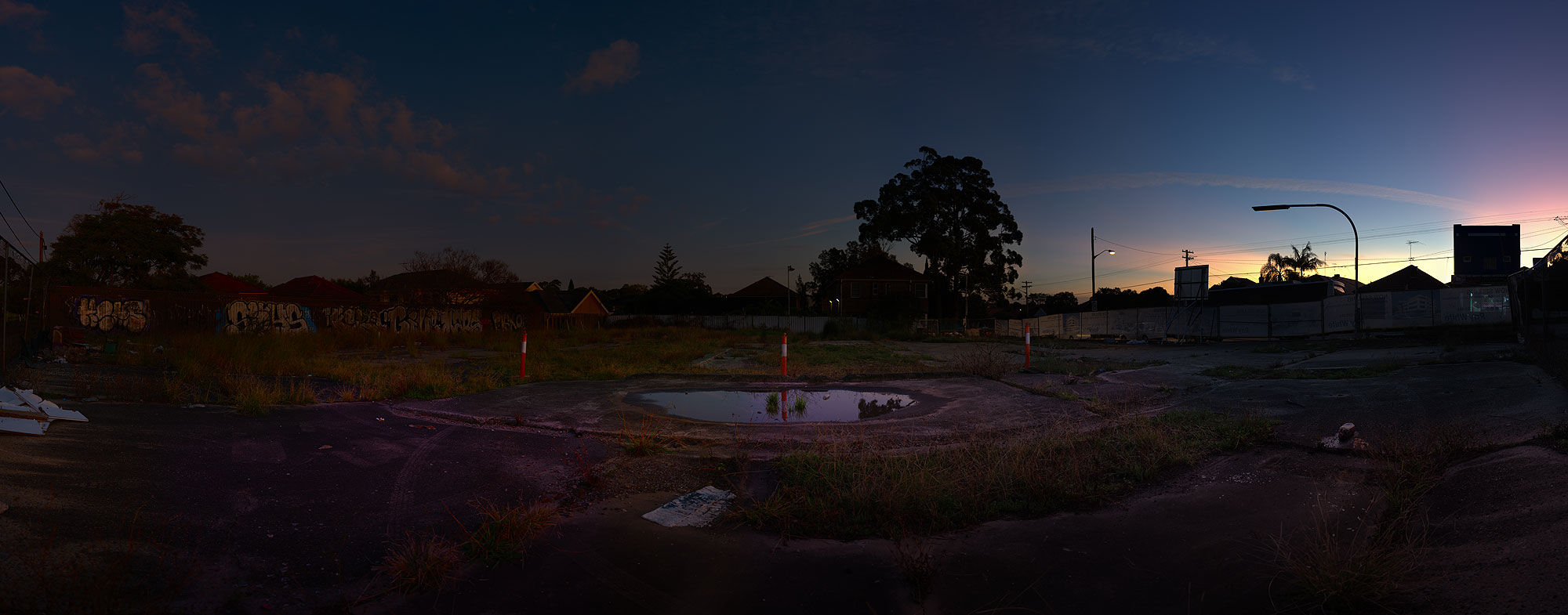
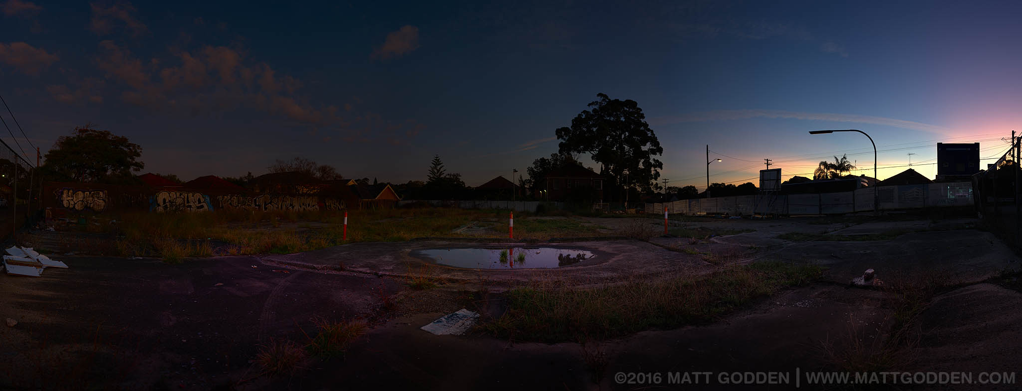
For years, this empty lot on Burwood Rd, the main street of Belmore, Sydney, has provided refuge to local wildlife, and a dumping ground for discarded furniture, rubbish, and unwanted stolen cellphones. Situated next to a public housing block in a lower socio-economic area, the fences covered in graffiti, this location has since succumbed to Sydney’s property developers, and is now the building site for a block of “luxury apartments”.

The title of the work is a play on the Serengeti, one of the world’s most famous, and photographed, ecosystems. “Ghetto” for the appearance of the site, in what is nevertheless a vibrant and diverse community experiencing the relentless march of gentrification, which tolerates no gentle decay, or fallow land.


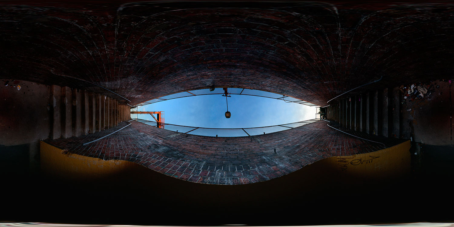
This location was shot as found, the arrangement of the orange traffic bollards serendipitous, and was accessed with the prior permission of the owner. If there’s one thing that can be salvaged from the debacle that was the Belmore warehouse experiment, it’s that I was able to create this image. At its full native size, it’s about 3 metres wide. If you’re interested in a print, get in touch to discuss sizes and costs.

railway pedestrian tunnel stairway

When it comes to panoramas, this is my masterwork so far.

The other end of the Enmore tunnel, it’s a pair of staircases, perpendicular to the tunnel itself, and is the very reason I got into panoramic imagery – to hunt down these filthy run down inner city locations, and find the beauty of their geometry. I’m going to get back into it in a big way in the near future hopefully.

railway pedestrian tunnel

This tunnel is one of the great and interesting locations of Enmore. Said to be haunted (suuuure) it’s almost certainly had its share of muggings and unpleasantness over the years. It’s such an obvious ambush location you can’t help but feel trepidation as you walk through it.

At one stage it was filled with graffiti, really good graffiti that must have been decades old, well before the artless tagging style that arose in the 90s. Much of it actually brushwork. The council in their wisdom decided to destroy that particular bit of local history and repaint it all with a fresh coat of yellow. In the 7 or so years since it’s filled with grafiti again, but it’s all spraycan tagging crap.

newtown at night

The main intersection of Newtown. To the left is King street and the Townie, to the right is Enmore Rd.

This was shot well after midnight on a weeknight, hence the lack of people.

a rural river

My father used to own a small farm property, and it had a river running through it. This was when rivers tended to have at least some water in them.

What I really like about this image is the tree in the foreground as compared to the background. From memory this is only a 90 degree field of view.

glebe point waterfront

This is, or at least was one of my favourite fishing locations, but they changed the lighting, so the water isn’t as well illuminated at night. As a result this wonderful location, such a short drive from home has more or less shut down.

Still, it’s a pretty picture. It’s also one of the most polluted places in Sydney, the sediments being filled with all sorts of crap from a hundred years worth of industrial use.

enmore design centre

This is the design college I was studying and working at for a while. It’s right down the bottom of the street I was living on at the time. Which was convenient to say the least.

trees of newtown cemetery

One great thing about these old cemeteries, they can often represent the last remaining areas of tree cover in densely populated inner city suburbs.

This is a nice vista of the whole area inside the graveyard walls.